A World Heritage island ecosystem
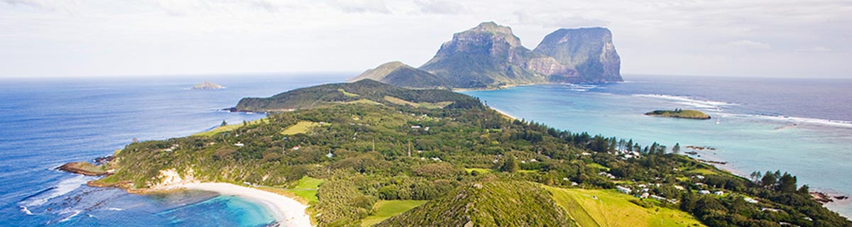
The Lord Howe Island Group (LHIG) was inscribed on the World Heritage Register under the United Nations' World Heritage Convention in recognition of its superlative natural phenomena and its rich terrestrial and marine biodiversity as an outstanding example of an island ecosystem developed from submarine volcanic activity.
Extent
The LHIG World Heritage Property covers an area of 146,300 hectares comprised of Lord Howe Island, the Admiralty Islands (North Rocks, Tenth of June, South Island and Roach Island), Mutton Bird Island, Blackburn Island, Gower Island, Balls Pyramid and offshore islets) and 145,000 hectares of marine environment. Lord Howe Island, the largest island in the LHIG, has an area of 1,455 hectares and is 11 km long and 2.8 km wide at its widest point.
Permanent Park Preserve
The islands are part of the State of New South Wales and are managed by the Lord Howe Island Board. Seventy-five per cent of the main island and all outlying islands are protected for conservation purposes as a Permanent Park Preserve.
Marine Park
The majority of the marine areas on the World Heritage Property are protected by the Lord Howe Island Marine Park (LHIMP), which covers both NSW State Coastal Waters (within three nautical miles of land) and Commonwealth Waters outside the three-mile limit.
Strategic Plan
A Strategic Plan for the Lord Howe Island Group World Heritage Property (2010) has been developed to provide a ten-year overarching framework for its consistent and coordinated management by the various NSW and Commonwealth agencies with responsibilities in the area.
The Lord Howe Island Board employs a Team Leader World Heritage to manage the Island's World Heritage values with assistance from the Federal government.
Further information about Lord Howe Island's World Heritage Listing can be obtained from: